#hikerchat - Adventure Planning
HikerChat
 TETONsports
replying to @BethanyHutson09 @BethanyHutson09 Those Facebook hiking groups are awesome! So many fantastic groups #hikerchat
 bushwhackingfoo
replying to @Lucyan_us @Lucyan_us A4. Depends on the trip. My biggest worry for bushwhacking trips is stream crossings, topo maps & aerial… https://t.co/pHKe2s07Ky
 MissouriHowell
replying to @TETONsports @TETONsports A5: CalTopo for paper maps and Gaia GPS for phone. #hikerchat
 kevinspocket
replying to @Lucyan_us @Lucyan_us A4: I like to overplan, this way I have options when weather or closures cause things to change #hikerchat
 danielhuman
A4 If I'm taking others out I am very detailed but on solo trips I'll wing it to a point as solo trips are about my flexibility #hikerchat
 MomsWanderlust
A4: I'm type A, so I'm a detailed planner. But I've learned to leave room for the unexpected. They are the best m… https://t.co/Mn7O1LGlEU
 t_jh2009
replying to @Lucyan_us @Lucyan_us A4) For my trip to Europe it was pretty detailed w/ train & tour schedules. Not so much for my recent trip to Idaho. #HikerChat
 HikingWithHendr
replying to @TETONsports @TETONsports A5) AllTrail is definitely my go to! #hikerchat
 InnTownCamp
replying to @TETONsports @TETONsports a5: I'm excited to tag along, the next Folk Trails Hiking Club is next week and it leaves from the cam… https://t.co/qHQymQZbdf
 X2JHiker
replying to @TETONsports @TETONsports A5 I use AllTrails, Google Maps, and REI's app #hikerchat
 TETONsports
replying to @k2rm @k2rm @billbrokob At least you know your chances of getting lost drop quite a bit. Also are trails as you expect them? #hikerchat
 mjn126
replying to @TETONsports @TETONsports A5: Google Maps, REI Hiking Project, ViewRanger. I have not been anywhere too complicated yet in my… https://t.co/bLY9mJXE7m
 afoxintheforest
replying to @TETONsports @TETONsports A5). Meg checking in! I use a good old paper map and compass combined with the topo maps + app. Love it! #hikerchat
 jaypeatravels
replying to @TETONsports @TETONsports Map and compass, for me, are the best. But I do have a handheld GPS and GPS mapping apps too. Maps are just cooler. #hikerchat
 MomsWanderlust
replying to @mjn126 @mjn126 I am glad so many new faces will have the opportunity to experience our greatest spots. I just hope they ar… https://t.co/HzmfL2QLHz
 bushwhackingfoo
replying to @TETONsports @TETONsports A5. For trails? Nothing but a map. For bushwhacking? Garmin GPS, maps & aerial photos. #hikerchat
 Todd_the_Hiker
replying to @Lucyan_us @Lucyan_us #HikerChat A4. On big trips I get very detailed, though I leave plenty of time for unplanned things along the way!
 jaypeatravels
replying to @X2JHiker @X2JHiker @TETONsports Yeah, second that, @REI NPS app is pretty sweet. #hikerchat
 bill_thegearguy
replying to @TETONsports @TETONsports A5 a good topo map in color and a compass. I've gotten pretty good at just using terrain association.… https://t.co/jEjsJKLTi2
 RCGibby73
replying to @TETONsports @TETONsports A5: I've found All Trails to be handy and am finding out about other apps as we chat! #hikerchat
 mjn126
replying to @MomsWanderlust @MomsWanderlust I'm interested to see how it all end, what kind of stats or research or conclusions come from it. #hikerchat #Canada150
 tthrash
"digital binding contracts of fun" perfect way to describe Twitter polls, at least the first (and last?) one I did.… https://t.co/yIBmedgYTU
 Lucyan_us
replying to @X2JHiker @X2JHiker @TETONsports I like All Trails too although sometimes the data are entirely correct #hikerchat
 WeekendWomanWar
replying to @TETONsports @TETONsports A5: I only use the sun and the stars for navigation. I'm old school that way. Also get lost a lot. 😜 #HikerChat
 TETONsports
replying to @bill_thegearguy @bill_thegearguy Topo maps are almost like pure art. I love them #Hikerchat
 TheSoCalHiker
RT @TETONsports: Q5. Which apps & tools do you use for trail orientation? #hikerchat
 AvenzaMaps
replying to @Lucyan_us @Lucyan_us A4. I like doing it, so I will spend as long as I can discovering tips and hot spots, and prepping. #hikerchat
 TETONsports
replying to @WeekendWomanWar @WeekendWomanWar hahah, at least you are using and learning tools that'll never run out of battery #hikerchat
 k2rm
k2rm
replying to @TETONsports @TETONsports @billbrokob Usually yes, actually. Half Dome was not at all what I expected. The hike was easier, the… https://t.co/FigqCSxAWW
 bushwhackingfoo
replying to @danielhuman @danielhuman @Lucyan_us That's the way I think too! #hikerchat
 Parks_Explorer
A3. If planning trip to #nationalpark, we use our free #VR apps to check top hikes & sights!… https://t.co/4Mc8qwna6l
 billbrokob
A5: Gaia and topo maps. I usually search for trip reports to get a feel for the terrain #hikerchat
 TheSoCalHiker
replying to @TETONsports @TETONsports A5: I use https://t.co/ZhyF8EZlnR for planning and @GaiaGPS for navigating and recording my path. #HikerChat
 TETONsports
replying to @X2JHiker @X2JHiker I just found out you can save the google maps offline for when you drop service. #MindBlown #hikerchat
 3UpAdventures
A5 I really love GaiaGPS for my phone. I used CalTopo alot for pre hike research #hikerchat
 Lucyan_us
Q6. #hikerchat What essentials do you always have to pack for hike/backpacking trip?
 TETONsports
replying to @TheSoCalHiker @TheSoCalHiker @gaiagps Just got Gaia, really loving it so far. #hikerchat
 TheSoCalHiker
RT @Lucyan_us: Q6. #hikerchat What essentials do you always have to pack for hike/backpacking trip?
 X2JHiker
replying to @TETONsports @TETONsports @bill_thegearguy I have a topo map book for the entire state of PA. I look it over often. #hikerchat
 TETONsports
RT @Lucyan_us: Q6. #hikerchat What essentials do you always have to pack for hike/backpacking trip?
 t_jh2009
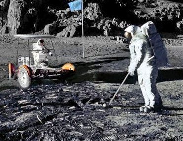
replying to @TETONsports @TETONsports @Mrs_Roadrunner Yeah, its not the best place to play golf. #HikerChat

 kevinspocket
replying to @TETONsports @TETONsports A5: I love my @nynjtc trail maps - favorite gps app is MotionX GPS 👍 #hikerchat
 HikingWithHendr
replying to @Lucyan_us @Lucyan_us @X2JHiker @TETONsports Yeah. It has tripped me up a few times, especially trying to find a trailhead. #hikerchat
 billbrokob
replying to @WeekendWomanWar @WeekendWomanWar @TETONsports Probably trip often as well :-) Always looking up #hikerchat


 RMhigh7088
 Mrs_Roadrunner